
Soil, this season
Spot a nitrogen shortfall in March, not at harvest.
Your fields, public data and the readings you choose to add, turned into this week’s decision and the record that proves it. For farms of 20 to 500 hectares in England and Wales.
Opens the app. No account until you want to keep the farm.
Every client farm’s legal dates on one Today, plans and packs that carry your name, and the approvals inbox for crop-protection questions. One licence, unlimited farms.
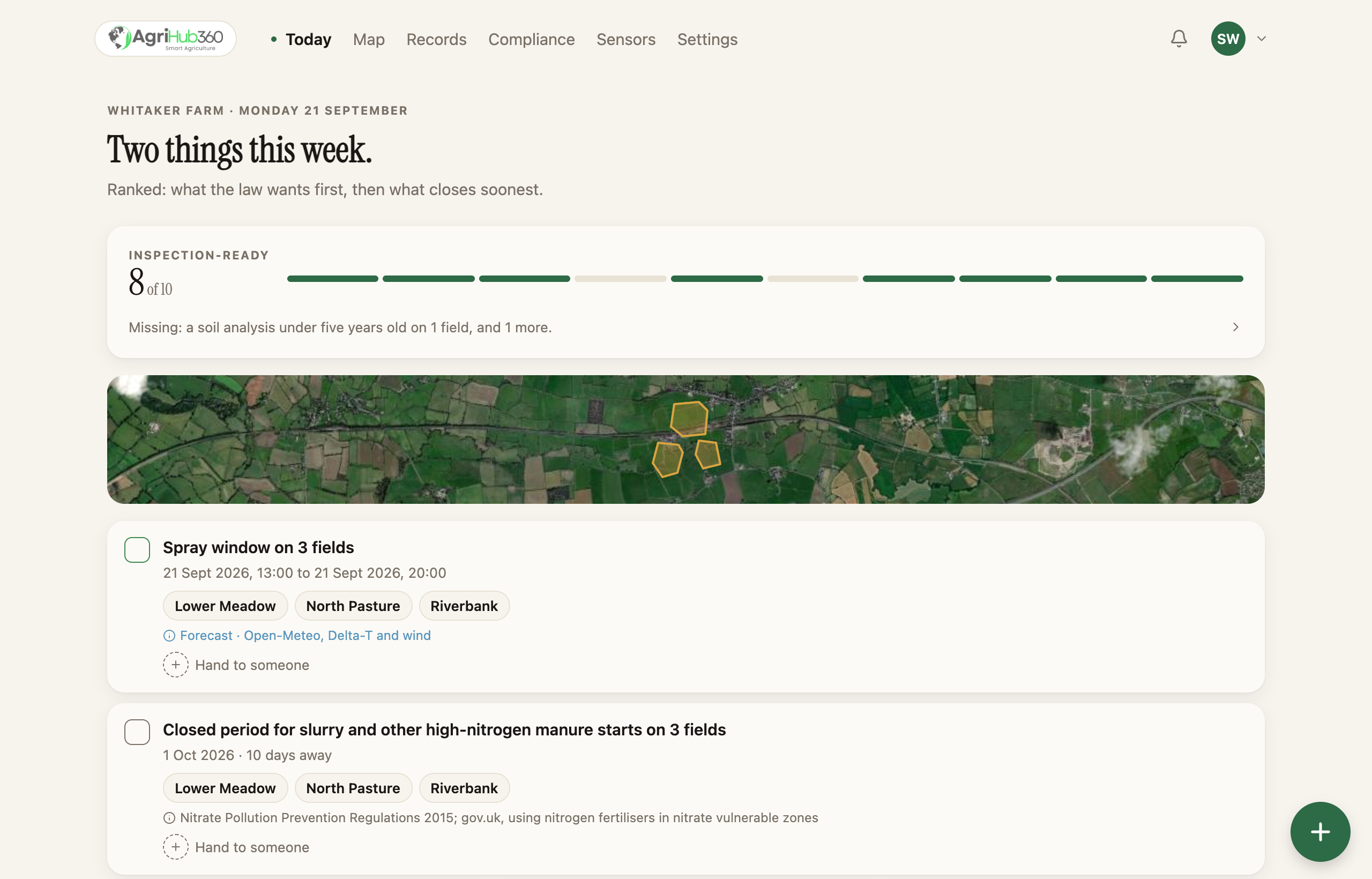
Where it came from
Every number says whether it is measured or modelled.
From your probe, from the nearest rain gauge, or from a model, and which.
Yours, full stop
Your farm data stays yours.
Never sold, never used to train third-party AI, and sharing is opt-in.
Before the inspector
The things the officer asks for, ticked or not.
The checks run while you work, not when the letter comes.
Two minutes through the app, from the first field to the pack, on the demo farms. No slides.
How it works
01 · Map
Upload the file the RPA already sent you. The list an officer works through fills itself in, item by item, each a tap from where it is fixed.
What each regime wants →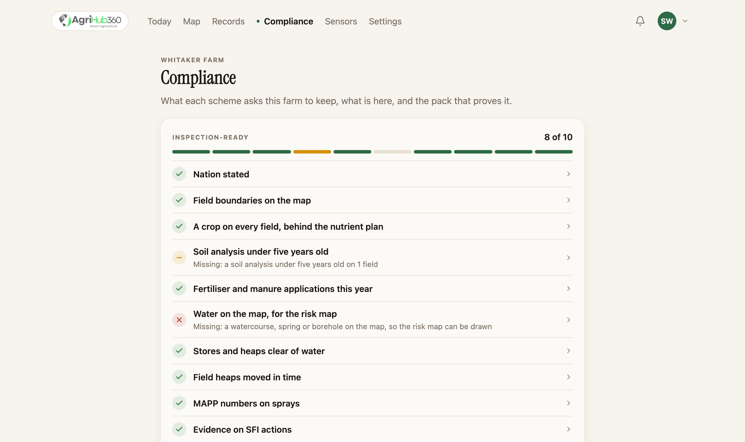
02 · Model
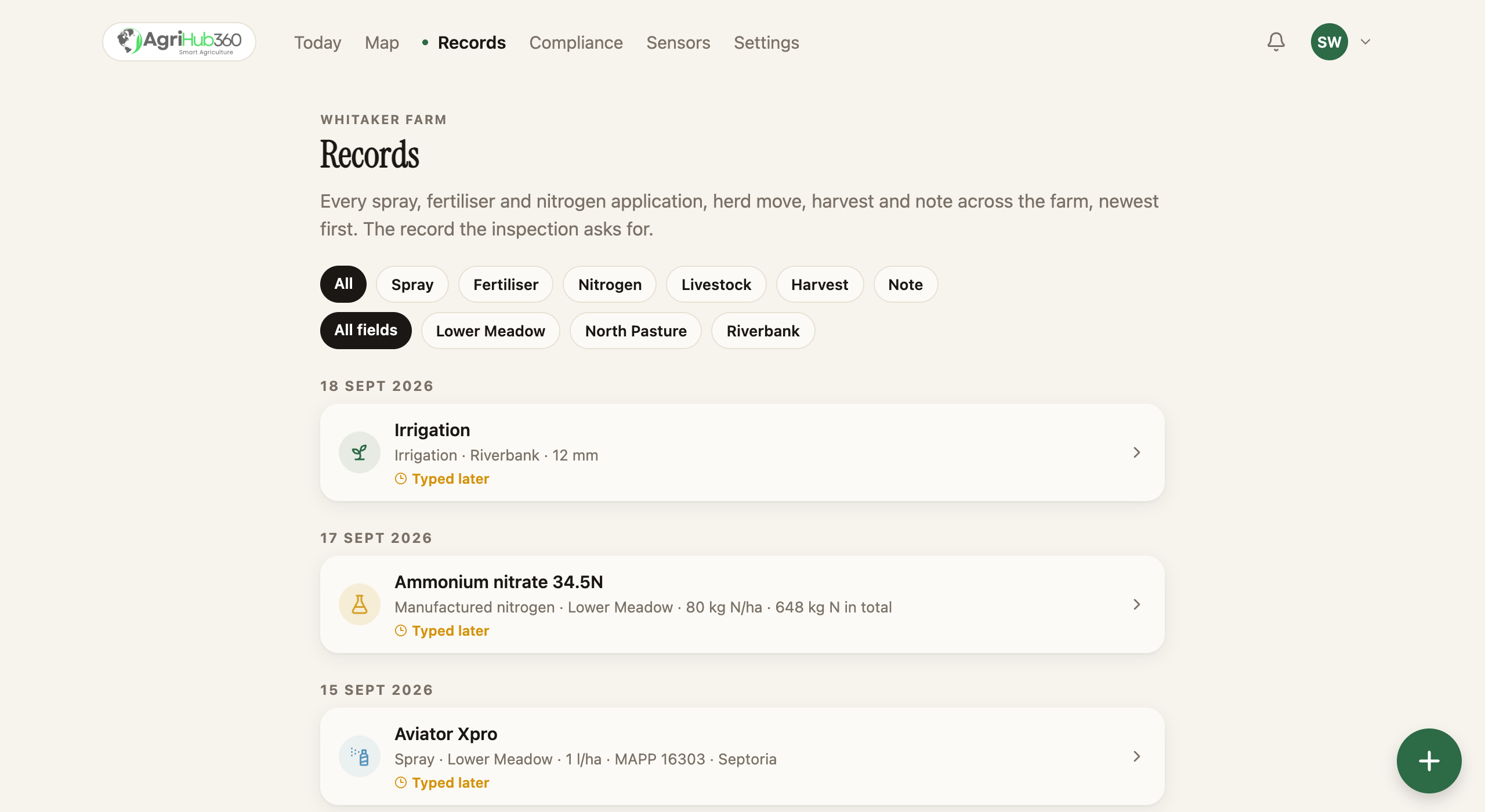
A spray with its MAPP number is already a line on the record. A photo goes on any entry. Kept for as long as the rule says.
03 · Measure
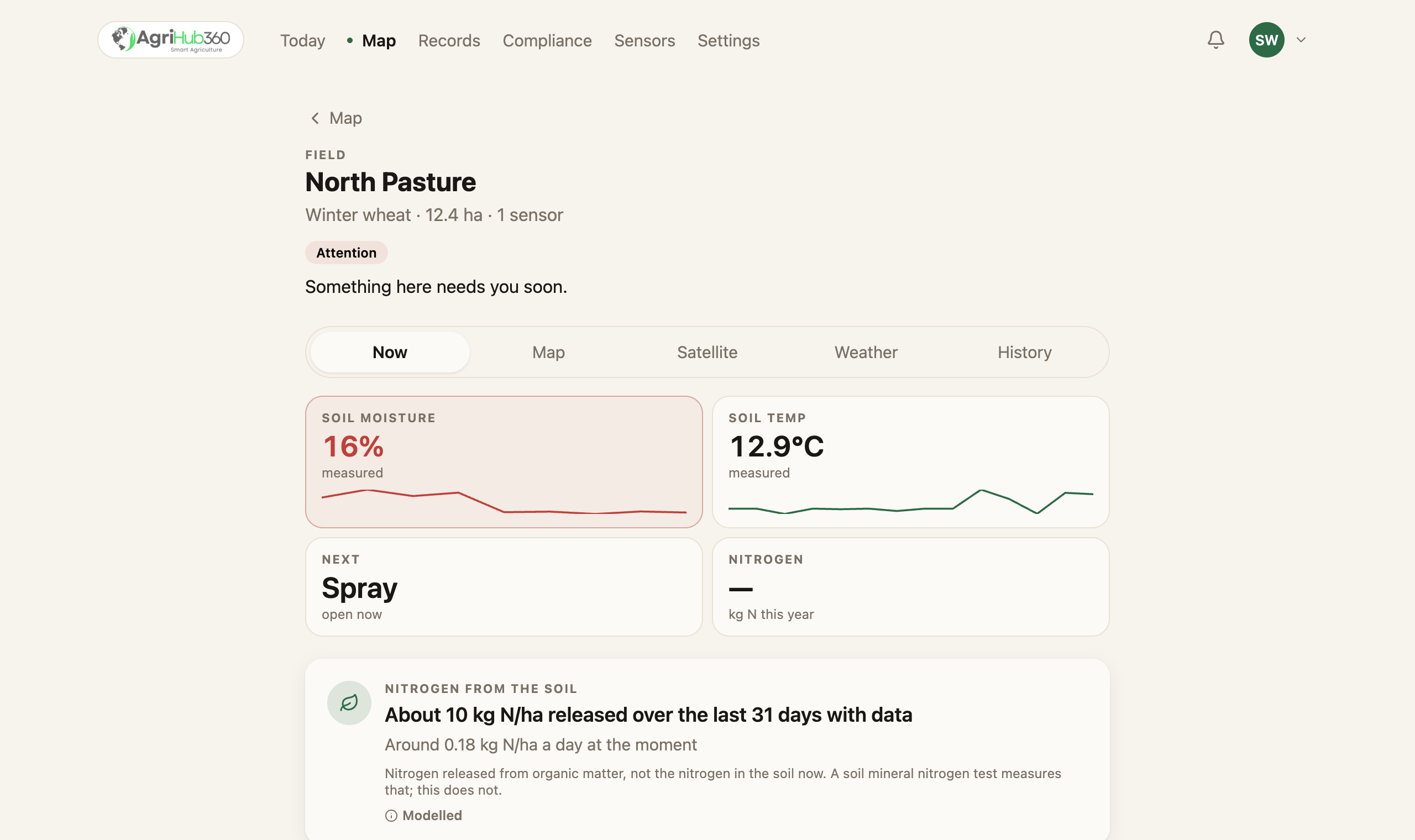
The free public model against your own reading, on the same field. Sometimes the answer is that you do not need a probe.
04 · Act
A weather station you already own posts in four lines typed into its gateway. Our sensors, or anyone’s, land on the field named as its own, and every reading says which device it came from.
Bring your own device →
Spot a nitrogen shortfall in March, not at harvest.
Each field gets its own plan, its own record and its own windows.
A drought-stress index per field, from the forecast and your soil moisture.
The inspection, itemised.
Every item an Environment Agency visit asks for, ticked or not, each a tap from where it is fixed.
The pack in the layouts the inspector knows.
Defra’s field record sheets, the Tried & Tested plan, the spray record in the Voluntary Initiative’s columns. One zip.
Write it once.
A spray with its MAPP number is already a line on the record. A photo goes on any entry.
First on the pilot farms around us in Somerset. Then on yours, wherever you farm.
Map your farm, freeData ownership
You compete on your land and your numbers. We treat them that way.
Read the full privacy commitments →Never sold.
We do not sell personal information to third parties.
Never trains third-party AI.
We do not use your data to train third-party AI models.
Sharing is opt-in, field by field.
Scout photos and harvest results are separate switches, off until you turn them on.